


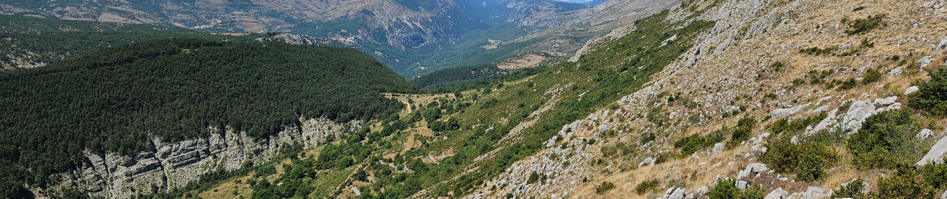
Coursegoule, Vierou, chapelle St Michel

GrouGary
User
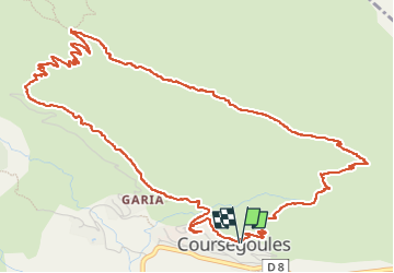

Length
8 km

Max alt
1415 m

Uphill gradient
422 m
Km-Effort
13.7 km

Min alt
1014 m

Downhill gradient
426 m
Boucle
Yes
Creation date :
2025-07-11 07:47:06.133
Updated on :
2025-07-12 13:18:14.405
5h30
Difficulty : Easy

FREE GPS app for hiking
 SityTrail
IGN / Geographical institutes
SityTrail Plus
The world is yours!
About
Trail Walking of 8 km to be discovered at Provence-Alpes-Côte d'Azur, Maritime Alps, Coursegoules. This trail is proposed by GrouGary.
Description
Petite boucle facile, sans difficultés techniques.
Petit vent, un 11 juillet
Photos


Positioning
Country:
France
Region :
Provence-Alpes-Côte d'Azur
Department/Province :
Maritime Alps
Municipality :
Coursegoules
Location:
Unknown
Start:(Dec)
Start:(UTM)
342691 ; 4850857 (32T) N.
Comments