


MONT OREL

nordan
User
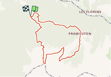

Length
10.8 km

Max alt
2562 m

Uphill gradient
795 m
Km-Effort
21 km

Min alt
1793 m

Downhill gradient
798 m
Boucle
Yes
Creation date :
2025-07-11 08:57:50.086
Updated on :
2025-07-11 14:29:03.706
3h35
Difficulty : Medium

FREE GPS app for hiking
 SityTrail
IGN / Geographical institutes
SityTrail Plus
The world is yours!
About
Trail Walking of 10.8 km to be discovered at Provence-Alpes-Côte d'Azur, Hautes-Alpes, Saint-André-d'Embrun. This trail is proposed by nordan.
Positioning
Country:
France
Region :
Provence-Alpes-Côte d'Azur
Department/Province :
Hautes-Alpes
Municipality :
Saint-André-d'Embrun
Location:
Unknown
Start:(Dec)
Start:(UTM)
307084 ; 4940694 (32T) N.
Comments