


Hauteur du clos Chevaleret 13.7.25

fredetpascale
User GUIDE
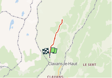

Length
8.1 km

Max alt
2232 m

Uphill gradient
378 m
Km-Effort
13.2 km

Min alt
1981 m

Downhill gradient
379 m
Boucle
Yes
Creation date :
2025-07-13 06:43:22.375
Updated on :
2025-07-13 12:04:30.231
3h00
Difficulty : Easy

FREE GPS app for hiking
 SityTrail
IGN / Geographical institutes
SityTrail Plus
The world is yours!
About
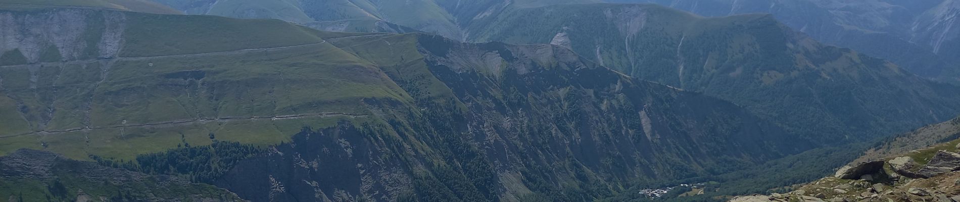
Trail Walking of 8.1 km to be discovered at Auvergne-Rhône-Alpes, Isère, Clavans-en-Haut-Oisans. This trail is proposed by fredetpascale.
Photos


Positioning
Country:
France
Region :
Auvergne-Rhône-Alpes
Department/Province :
Isère
Municipality :
Clavans-en-Haut-Oisans
Location:
Unknown
Start:(Dec)
Start:(UTM)
275563 ; 4996681 (32T) N.
Comments