


Petit Vignemale par l’Etang de Gaube

lebarça
User
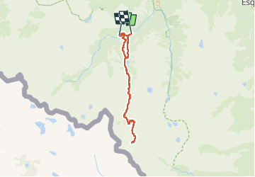

Length
29 km

Max alt
3014 m

Uphill gradient
1605 m
Km-Effort
50 km

Min alt
1464 m

Downhill gradient
1668 m
Boucle
No
Creation date :
2025-07-14 04:52:06.0
Updated on :
2025-07-14 16:48:22.23
11h44
Difficulty : Very difficult

FREE GPS app for hiking
 SityTrail
IGN / Geographical institutes
SityTrail Plus
The world is yours!
About
Trail Walking of 29 km to be discovered at Occitania, Hautespyrenees, Cauterets. This trail is proposed by lebarça.
Positioning
Country:
France
Region :
Occitania
Department/Province :
Hautespyrenees
Municipality :
Cauterets
Location:
Unknown
Start:(Dec)
Start:(UTM)
733088 ; 4748293 (30T) N.
Comments