


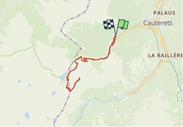
Pic de Net

sdroneau
User

Length
17.3 km

Max alt
2421 m

Uphill gradient
1088 m
Km-Effort
32 km

Min alt
1355 m

Downhill gradient
1084 m
Boucle
Yes
Creation date :
2025-07-15 05:27:47.54
Updated on :
2025-07-15 11:02:12.677
5h10
Difficulty : Very difficult

FREE GPS app for hiking
 SityTrail
IGN / Geographical institutes
SityTrail Plus
The world is yours!
About
Trail Walking of 17.3 km to be discovered at Occitania, Hautespyrenees, Cauterets. This trail is proposed by sdroneau.
Positioning
Country:
France
Region :
Occitania
Department/Province :
Hautespyrenees
Municipality :
Cauterets
Location:
Unknown
Start:(Dec)
Start:(UTM)
733325 ; 4751751 (30T) N.
Comments