


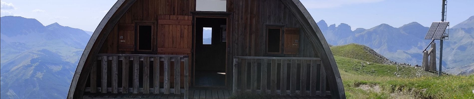
cime de l aspre depuis St Martin d entraunes

baygonvert
User
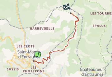

Length
11 km

Max alt
2451 m

Uphill gradient
1486 m
Km-Effort
26 km

Min alt
1006 m

Downhill gradient
47 m
Boucle
No
Creation date :
2025-07-05 09:29:52.335
Updated on :
2025-07-15 15:17:14.175
4h53
Difficulty : Very difficult

FREE GPS app for hiking
 SityTrail
IGN / Geographical institutes
SityTrail Plus
The world is yours!
About
Trail Walking of 11 km to be discovered at Provence-Alpes-Côte d'Azur, Maritime Alps, Saint-Martin-d'Entraunes. This trail is proposed by baygonvert.
Photos

Positioning
Country:
France
Region :
Provence-Alpes-Côte d'Azur
Department/Province :
Maritime Alps
Municipality :
Saint-Martin-d'Entraunes
Location:
Unknown
Start:(Dec)
Start:(UTM)
321369 ; 4889531 (32T) N.
Comments