


picherande

michelbarc
User
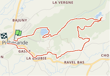

Length
6.7 km

Max alt
1210 m

Uphill gradient
174 m
Km-Effort
9 km

Min alt
1071 m

Downhill gradient
185 m
Boucle
Yes
Creation date :
2025-07-16 12:48:03.006
Updated on :
2025-07-16 16:00:26.518
3h07
Difficulty : Medium

FREE GPS app for hiking
 SityTrail
IGN / Geographical institutes
SityTrail Plus
The world is yours!
About
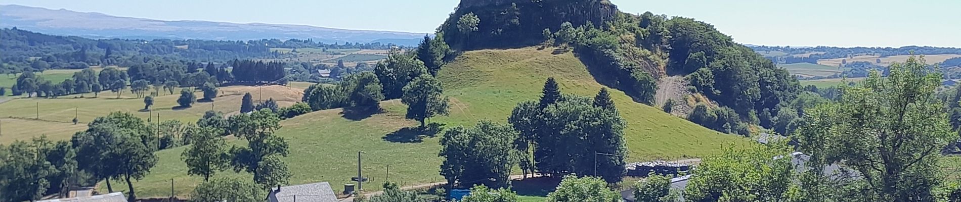
Trail Walking of 6.7 km to be discovered at Auvergne-Rhône-Alpes, Puy-de-Dôme, Picherande. This trail is proposed by michelbarc.
Photos


Positioning
Country:
France
Region :
Auvergne-Rhône-Alpes
Department/Province :
Puy-de-Dôme
Municipality :
Picherande
Location:
Unknown
Start:(Dec)
Start:(UTM)
481988 ; 5034631 (31T) N.
Comments