


Bouziés

Gbreuilh
User

Length
10.4 km

Max alt
280 m

Uphill gradient
387 m
Km-Effort
15.6 km

Min alt
129 m

Downhill gradient
387 m
Boucle
Yes
Creation date :
2025-07-16 16:53:42.942
Updated on :
2025-07-16 16:53:43.988
3h32
Difficulty : Difficult

FREE GPS app for hiking
 SityTrail
IGN / Geographical institutes
SityTrail Plus
The world is yours!
About
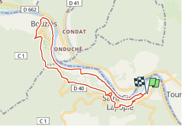
Trail Walking of 10.4 km to be discovered at Occitania, Lot, Saint-Cirq-Lapopie. This trail is proposed by Gbreuilh.
Positioning
Country:
France
Region :
Occitania
Department/Province :
Lot
Municipality :
Saint-Cirq-Lapopie
Location:
Unknown
Start:(Dec)
Start:(UTM)
394837 ; 4924582 (31T) N.
Comments