


tour machy vignes

ophness
User
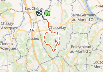

Length
9.9 km

Max alt
427 m

Uphill gradient
282 m
Km-Effort
13.6 km

Min alt
205 m

Downhill gradient
282 m
Boucle
Yes
Creation date :
2025-07-16 17:16:12.108
Updated on :
2025-07-16 17:16:17.663
1h47
Difficulty : Easy

FREE GPS app for hiking
 SityTrail
IGN / Geographical institutes
SityTrail Plus
The world is yours!
About
Trail Horseback riding of 9.9 km to be discovered at Auvergne-Rhône-Alpes, Rhône, Les Chères. This trail is proposed by ophness.
Positioning
Country:
France
Region :
Auvergne-Rhône-Alpes
Department/Province :
Rhône
Municipality :
Les Chères
Location:
Unknown
Start:(Dec)
Start:(UTM)
636143 ; 5082276 (31T) N.
Comments