


Elix JP

ClubAgeHeureux
User

Length
8.3 km

Max alt
251 m

Uphill gradient
46 m
Km-Effort
8.9 km

Min alt
228 m

Downhill gradient
44 m
Boucle
Yes
Creation date :
2025-07-17 07:02:28.707
Updated on :
2025-07-17 09:11:43.674
1h49
Difficulty : Medium

FREE GPS app for hiking
 SityTrail
IGN / Geographical institutes
SityTrail Plus
The world is yours!
About
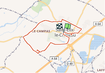
Trail Walking of 8.3 km to be discovered at Occitania, Haute-Garonne, Saint-Élix-le-Château. This trail is proposed by ClubAgeHeureux.
Photos


Positioning
Country:
France
Region :
Occitania
Department/Province :
Haute-Garonne
Municipality :
Saint-Élix-le-Château
Location:
Unknown
Start:(Dec)
Start:(UTM)
348753 ; 4793610 (31T) N.
Comments