


du grand Echaillon au col de la Bataille par la route Comblezine

verozerr
User
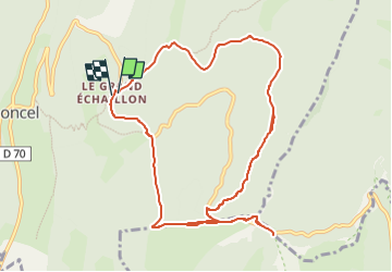

Length
11.9 km

Max alt
1356 m

Uphill gradient
313 m
Km-Effort
16 km

Min alt
1151 m

Downhill gradient
305 m
Boucle
Yes
Creation date :
2025-07-18 14:28:54.855
Updated on :
2025-07-18 14:28:57.013
3h38
Difficulty : Difficult

FREE GPS app for hiking
 SityTrail
IGN / Geographical institutes
SityTrail Plus
The world is yours!
About
Trail Walking of 11.9 km to be discovered at Auvergne-Rhône-Alpes, Drôme, Léoncel. This trail is proposed by verozerr.
Description
par la route forestière du Gambeloux et de Comblezine
Positioning
Country:
France
Region :
Auvergne-Rhône-Alpes
Department/Province :
Drôme
Municipality :
Léoncel
Location:
Unknown
Start:(Dec)
Start:(UTM)
674385 ; 4975711 (31T) N.
Comments