


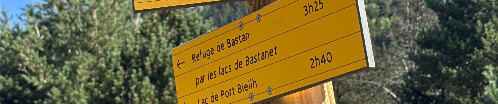
J7-Oule-Bastan

ETMU5496
User
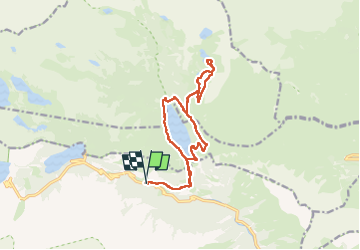

Length
16.8 km

Max alt
2231 m

Uphill gradient
808 m
Km-Effort
28 km

Min alt
1597 m

Downhill gradient
807 m
Boucle
Yes
Creation date :
2025-07-21 07:50:53.0
Updated on :
2025-07-24 17:34:26.208
7h33
Difficulty : Medium

FREE GPS app for hiking
 SityTrail
IGN / Geographical institutes
SityTrail Plus
The world is yours!
About
Trail Walking of 16.8 km to be discovered at Occitania, Hautespyrenees, Aragnouet. This trail is proposed by ETMU5496.
Description
IBP=99
Photos


Positioning
Country:
France
Region :
Occitania
Department/Province :
Hautespyrenees
Municipality :
Aragnouet
Location:
Unknown
Start:(Dec)
Start:(UTM)
270266 ; 4744549 (31T) N.
Comments