


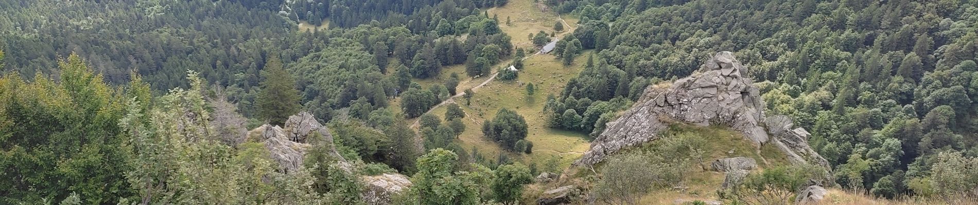
Pic du Hohneck

nana1643
User
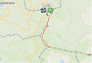

Length
4.5 km

Max alt
1355 m

Uphill gradient
123 m
Km-Effort
6.2 km

Min alt
1229 m

Downhill gradient
123 m
Boucle
Yes
Creation date :
2025-07-23 08:01:39.733
Updated on :
2025-07-23 09:48:07.233
1h25
Difficulty : Medium

FREE GPS app for hiking
 SityTrail
IGN / Geographical institutes
SityTrail Plus
The world is yours!
About
Trail Walking of 4.5 km to be discovered at Grand Est, Vosges, Xonrupt-Longemer. This trail is proposed by nana1643.
Description
Beau Panorama
Photos


Positioning
Country:
France
Region :
Grand Est
Department/Province :
Vosges
Municipality :
Xonrupt-Longemer
Location:
Unknown
Start:(Dec)
Start:(UTM)
352042 ; 5323969 (32U) N.
Comments