


Biercée

schef
User
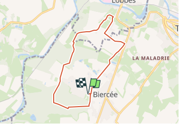

Length
7 km

Max alt
176 m

Uphill gradient
81 m
Km-Effort
8 km

Min alt
139 m

Downhill gradient
81 m
Boucle
Yes
Creation date :
2025-07-23 13:48:05.416
Updated on :
2025-07-23 13:48:56.226
0m
Difficulty : Medium

FREE GPS app for hiking
 SityTrail
IGN / Geographical institutes
SityTrail Plus
The world is yours!
About
Trail Nordic walking of 7 km to be discovered at Wallonia, Hainaut, Thuin. This trail is proposed by schef.
Positioning
Country:
Belgium
Region :
Wallonia
Department/Province :
Hainaut
Municipality :
Thuin
Location:
Unknown
Start:(Dec)
Start:(UTM)
589215 ; 5575537 (31U) N.
Comments