


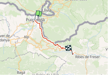
J4 De Puigcerda à Planoles
© OpenStreetMap contributors


9h24
Difficulty : Very difficult


Length
28 km
Max alt
1998 m
Uphill gradient
1067 m
Km-Effort
42 km
Min alt
1070 m
Downhill gradient
1148 m
Boucle
No
Creation date :
2025-07-23 04:39:44.0
Updated on :
2025-07-23 14:06:19.058
9h24
Difficulty : Very difficult
FREE GPS app for hiking
 SityTrail
IGN / Geographical institutes
SityTrail Plus
The world is yours!
About
Trail Walking of 28 km to be discovered at Catalonia, Girona, Puigcerdà. This trail is proposed by 000549.742464c1b03a4f089954791b77f25409.1417.
Positioning
Country:
Spain
Region :
Catalonia
Department/Province :
Girona
Municipality :
Puigcerdà
Location:
Unknown
Start:(Dec)
Start:(UTM)
411599 ; 4698055 (31T) N.
Comments