


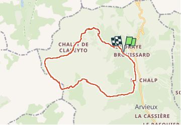
Chalets de Clapeyto et col de Neal

charollois
User

Length
17.6 km

Max alt
2574 m

Uphill gradient
950 m
Km-Effort
30 km

Min alt
1722 m

Downhill gradient
949 m
Boucle
Yes
Creation date :
2025-07-24 06:52:39.0
Updated on :
2025-07-24 15:18:01.859
4h50
Difficulty : Medium

FREE GPS app for hiking
 SityTrail
IGN / Geographical institutes
SityTrail Plus
The world is yours!
About
Trail Walking of 17.6 km to be discovered at Provence-Alpes-Côte d'Azur, Hautes-Alpes, Arvieux. This trail is proposed by charollois.
Description
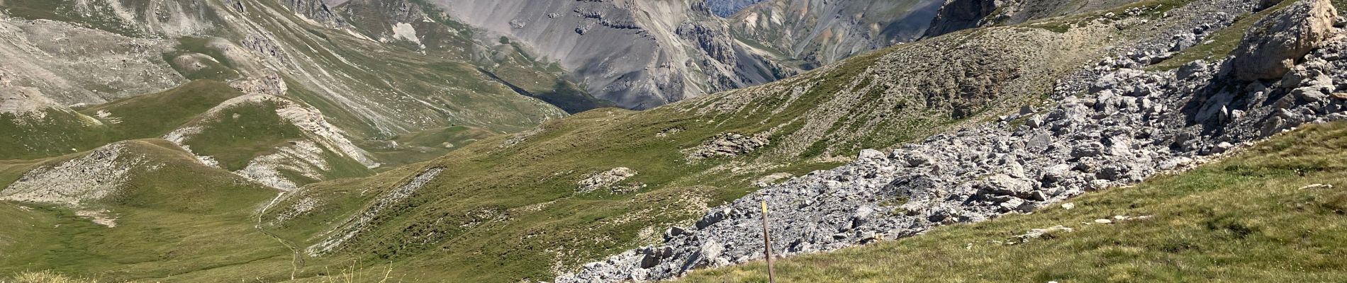
Varié - panorama - ombre et soleil. Jolis chalets de Clapeyto.
Photos

Positioning
Country:
France
Region :
Provence-Alpes-Côte d'Azur
Department/Province :
Hautes-Alpes
Municipality :
Arvieux
Location:
Unknown
Start:(Dec)
Start:(UTM)
319990 ; 4962666 (32T) N.
Comments