


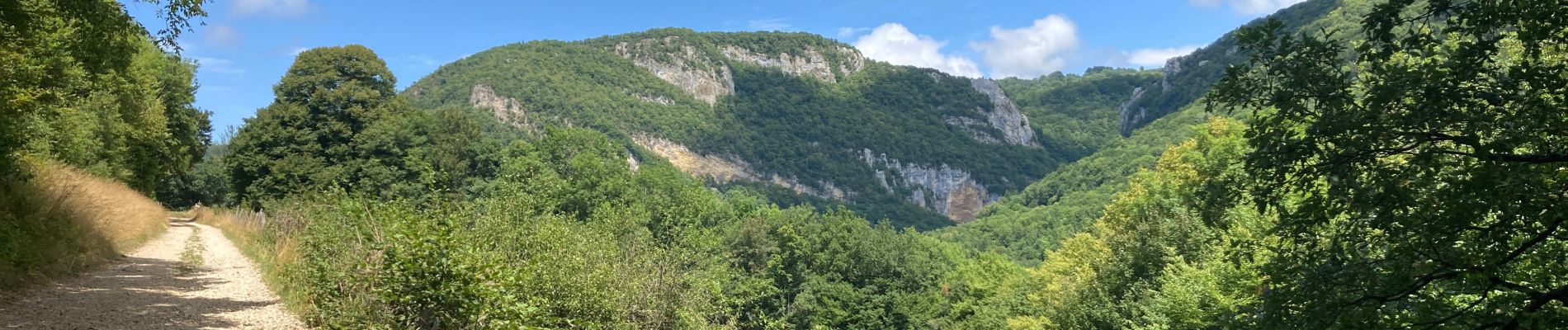
Bénonces

jpblimond
User

Length
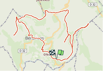
16.6 km

Max alt
743 m

Uphill gradient
615 m
Km-Effort
25 km

Min alt
435 m

Downhill gradient
618 m
Boucle
Yes
Creation date :
2025-07-24 11:22:47.0
Updated on :
2025-07-25 07:55:46.108
5h00
Difficulty : Medium

FREE GPS app for hiking
 SityTrail
IGN / Geographical institutes
SityTrail Plus
The world is yours!
About
Trail Walking of 16.6 km to be discovered at Auvergne-Rhône-Alpes, Ain, Bénonces. This trail is proposed by jpblimond.
Photos


Positioning
Country:
France
Region :
Auvergne-Rhône-Alpes
Department/Province :
Ain
Municipality :
Bénonces
Location:
Unknown
Start:(Dec)
Start:(UTM)
693198 ; 5076960 (31T) N.
Comments