


St jean /st Jean (boucle 2025)

banga
User

Length
11.3 km

Max alt
1039 m

Uphill gradient
206 m
Km-Effort
14 km

Min alt
954 m

Downhill gradient
209 m
Boucle
Yes
Creation date :
2025-07-24 18:44:35.343
Updated on :
2025-07-24 18:45:45.823
3h11
Difficulty : Easy

FREE GPS app for hiking
 SityTrail
IGN / Geographical institutes
SityTrail Plus
The world is yours!
About
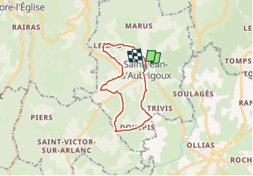
Trail On foot of 11.3 km to be discovered at Auvergne-Rhône-Alpes, Haute-Loire, Saint-Jean-d'Aubrigoux. This trail is proposed by banga.
Positioning
Country:
France
Region :
Auvergne-Rhône-Alpes
Department/Province :
Haute-Loire
Municipality :
Saint-Jean-d'Aubrigoux
Location:
Unknown
Start:(Dec)
Start:(UTM)
563660 ; 5023280 (31T) N.
Comments