


tinderets-chezery

lebretonjd
User
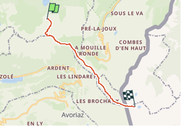

Length
8.2 km

Max alt
1999 m

Uphill gradient
621 m
Km-Effort
14.9 km

Min alt
1490 m

Downhill gradient
140 m
Boucle
No
Creation date :
2025-07-25 17:50:30.679
Updated on :
2025-07-25 17:50:32.289
3h22
Difficulty : Difficult

FREE GPS app for hiking
 SityTrail
IGN / Geographical institutes
SityTrail Plus
The world is yours!
About
Trail Walking of 8.2 km to be discovered at Auvergne-Rhône-Alpes, Upper Savoy, Abondance. This trail is proposed by lebretonjd.
Positioning
Country:
France
Region :
Auvergne-Rhône-Alpes
Department/Province :
Upper Savoy
Municipality :
Abondance
Location:
Unknown
Start:(Dec)
Start:(UTM)
326745 ; 5122917 (32T) N.
Comments