


Sault - Mont de la Peine

frizou83
User
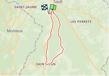

Length
12.2 km

Max alt
1057 m

Uphill gradient
413 m
Km-Effort
17.7 km

Min alt
691 m

Downhill gradient
413 m
Boucle
Yes
Creation date :
2025-07-25 21:01:50.815
Updated on :
2025-07-25 21:04:14.035
4h01
Difficulty : Difficult

FREE GPS app for hiking
 SityTrail
IGN / Geographical institutes
SityTrail Plus
The world is yours!
About
Trail Walking of 12.2 km to be discovered at Provence-Alpes-Côte d'Azur, Vaucluse, Sault. This trail is proposed by frizou83.
Positioning
Country:
France
Region :
Provence-Alpes-Côte d'Azur
Department/Province :
Vaucluse
Municipality :
Sault
Location:
Unknown
Start:(Dec)
Start:(UTM)
692040 ; 4883709 (31T) N.
Comments