


Lambesc ouest 25 07 25

didierc13
User
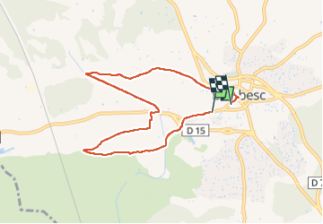

Length
7.9 km

Max alt
209 m

Uphill gradient
89 m
Km-Effort
9 km

Min alt
153 m

Downhill gradient
83 m
Boucle
No
Creation date :
2025-07-26 06:25:17.0
Updated on :
2025-07-26 08:17:31.232
1h51
Difficulty : Medium

FREE GPS app for hiking
 SityTrail
IGN / Geographical institutes
SityTrail Plus
The world is yours!
About
Trail Walking of 7.9 km to be discovered at Provence-Alpes-Côte d'Azur, Bouches-du-Rhône, Lambesc. This trail is proposed by didierc13.
Positioning
Country:
France
Region :
Provence-Alpes-Côte d'Azur
Department/Province :
Bouches-du-Rhône
Municipality :
Lambesc
Location:
Unknown
Start:(Dec)
Start:(UTM)
682002 ; 4835673 (31T) N.
Comments