


Nant (Egalières, canalettes)

coulombf
User
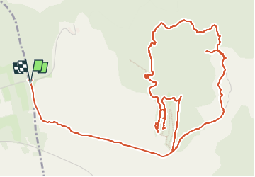

Length
9.7 km

Max alt
737 m

Uphill gradient
134 m
Km-Effort
11.5 km

Min alt
680 m

Downhill gradient
137 m
Boucle
Yes
Creation date :
2025-07-26 14:05:51.528
Updated on :
2025-08-01 21:58:55.665
2h36
Difficulty : Easy

FREE GPS app for hiking
 SityTrail
IGN / Geographical institutes
SityTrail Plus
The world is yours!
About
Trail Walking of 9.7 km to be discovered at Occitania, Aveyron, Nant. This trail is proposed by coulombf.
Description
31/07/2025 reconnaissance par groupe marche FC
La Gazette n°1936 du 24 au 31/07/2025
Positioning
Country:
France
Region :
Occitania
Department/Province :
Aveyron
Municipality :
Nant
Location:
Unknown
Start:(Dec)
Start:(UTM)
518933 ; 4869441 (31T) N.
Comments