


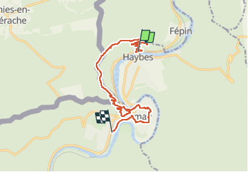
haybes, 2025.07.25

trusgnachjf
User

Length
13 km

Max alt
373 m

Uphill gradient
448 m
Km-Effort
18.9 km

Min alt
114 m

Downhill gradient
445 m
Boucle
No
Creation date :
2025-07-26 08:22:21.448
Updated on :
2025-07-26 14:54:59.709
6h32
Difficulty : Difficult

FREE GPS app for hiking
 SityTrail
IGN / Geographical institutes
SityTrail Plus
The world is yours!
About
Trail Walking of 13 km to be discovered at Grand Est, Ardennes, Haybes. This trail is proposed by trusgnachjf.
Positioning
Country:
France
Region :
Grand Est
Department/Province :
Ardennes
Municipality :
Haybes
Location:
Unknown
Start:(Dec)
Start:(UTM)
622195 ; 5541348 (31U) N.
Comments