


Lac d'Aygue Rouye

chasle
User
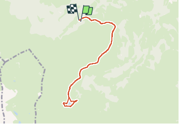

Length
9.1 km

Max alt
1626 m

Uphill gradient
438 m
Km-Effort
14.9 km

Min alt
1201 m

Downhill gradient
448 m
Boucle
Yes
Creation date :
2025-07-27 06:56:54.835
Updated on :
2025-07-27 15:40:32.4
3h23
Difficulty : Difficult

FREE GPS app for hiking
 SityTrail
IGN / Geographical institutes
SityTrail Plus
The world is yours!
About
Trail Walking of 9.1 km to be discovered at Occitania, Hautespyrenees, Campan. This trail is proposed by chasle.
Positioning
Country:
France
Region :
Occitania
Department/Province :
Hautespyrenees
Municipality :
Campan
Location:
Unknown
Start:(Dec)
Start:(UTM)
270025 ; 4763237 (31T) N.
Comments