


Saussat

georghinio
User
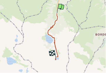

Length
7.2 km

Max alt
1973 m

Uphill gradient
853 m
Km-Effort
16 km

Min alt
1151 m

Downhill gradient
81 m
Boucle
No
Creation date :
2025-07-25 14:27:21.0
Updated on :
2025-07-28 04:45:04.264

FREE GPS app for hiking
 SityTrail
IGN / Geographical institutes
SityTrail Plus
The world is yours!
About
Trail of 7.2 km to be discovered at Occitania, Haute-Garonne, Oô. This trail is proposed by georghinio.
Positioning
Country:
France
Region :
Occitania
Department/Province :
Haute-Garonne
Municipality :
Oô
Location:
Unknown
Start:(Dec)
Start:(UTM)
295593 ; 4737530 (31T) N.
Comments