


Perdiguere

georghinio
User
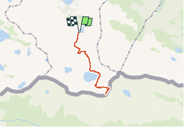

Length
13.6 km

Max alt
3200 m

Uphill gradient
1303 m
Km-Effort
31 km

Min alt
1924 m

Downhill gradient
1303 m
Boucle
Yes
Creation date :
2025-07-26 08:11:43.0
Updated on :
2025-07-28 04:45:08.541

FREE GPS app for hiking
 SityTrail
IGN / Geographical institutes
SityTrail Plus
The world is yours!
About
Trail of 13.6 km to be discovered at Occitania, Haute-Garonne, Oô. This trail is proposed by georghinio.
Positioning
Country:
France
Region :
Occitania
Department/Province :
Haute-Garonne
Municipality :
Oô
Location:
Unknown
Start:(Dec)
Start:(UTM)
295392 ; 4733031 (31T) N.
Comments