


cirque de Lys et col de Ripeyre par Pragnère

Bruno Devigne
User
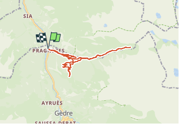

Length
16.7 km

Max alt
1659 m

Uphill gradient
1111 m
Km-Effort
31 km

Min alt
909 m

Downhill gradient
1109 m
Boucle
Yes
Creation date :
2025-07-28 09:34:27.574
Updated on :
2025-07-28 14:01:30.526
3h48
Difficulty : Difficult

FREE GPS app for hiking
 SityTrail
IGN / Geographical institutes
SityTrail Plus
The world is yours!
About
Trail Walking of 16.7 km to be discovered at Occitania, Hautespyrenees, Gavarnie-Gèdre. This trail is proposed by Bruno Devigne.
Description
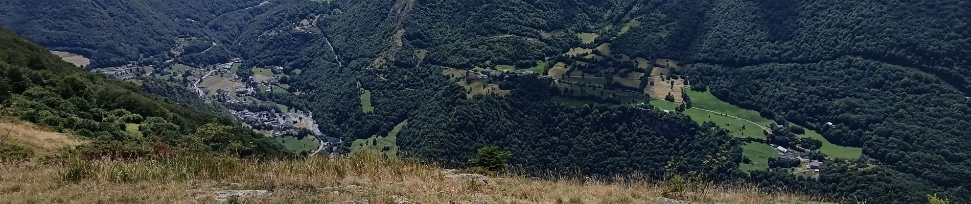
moyen pour aller au cirque et pente plus prononcée pour le col, très arboré et vue splendide.
Photos


Positioning
Country:
France
Region :
Occitania
Department/Province :
Hautespyrenees
Municipality :
Gavarnie-Gèdre
Location:
Gèdre
Start:(Dec)
Start:(UTM)
255560 ; 4745242 (31T) N.
Comments