


Poncin

jpblimond
User
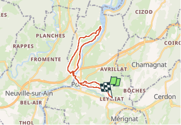

Length
13.1 km

Max alt
371 m

Uphill gradient
268 m
Km-Effort
16.6 km

Min alt
252 m

Downhill gradient
270 m
Boucle
No
Creation date :
2025-07-28 13:51:30.0
Updated on :
2025-07-28 17:17:02.192
3h24
Difficulty : Easy

FREE GPS app for hiking
 SityTrail
IGN / Geographical institutes
SityTrail Plus
The world is yours!
About
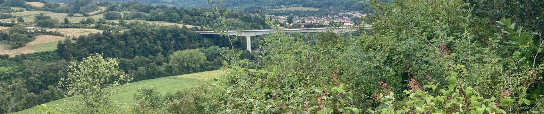
Trail Walking of 13.1 km to be discovered at Auvergne-Rhône-Alpes, Ain, Poncin. This trail is proposed by jpblimond.
Photos


Positioning
Country:
France
Region :
Auvergne-Rhône-Alpes
Department/Province :
Ain
Municipality :
Poncin
Location:
Unknown
Start:(Dec)
Start:(UTM)
687567 ; 5106022 (31T) N.
Comments