


Rif Didier 29072025

dblix
User
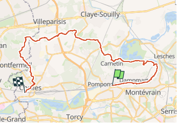

Length
33 km

Max alt
134 m

Uphill gradient
395 m
Km-Effort
39 km

Min alt
37 m

Downhill gradient
391 m
Boucle
No
Creation date :
2025-07-29 07:08:46.0
Updated on :
2025-07-30 07:17:08.024
8h45
Difficulty : Very difficult

FREE GPS app for hiking
 SityTrail
IGN / Geographical institutes
SityTrail Plus
The world is yours!
About
Trail Walking of 33 km to be discovered at Ile-de-France, Seine-et-Marne, Thorigny-sur-Marne. This trail is proposed by dblix.
Positioning
Country:
France
Region :
Ile-de-France
Department/Province :
Seine-et-Marne
Municipality :
Thorigny-sur-Marne
Location:
Unknown
Start:(Dec)
Start:(UTM)
478363 ; 5414238 (31U) N.
Comments