


estantens l'aouach fait juillet 25

pidjam
User
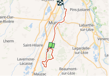

Length
21 km

Max alt
298 m

Uphill gradient
305 m
Km-Effort
25 km

Min alt
161 m

Downhill gradient
317 m
Boucle
No
Creation date :
2025-07-31 06:42:32.333
Updated on :
2025-07-31 10:16:36.507
2h43
Difficulty : Easy

FREE GPS app for hiking
 SityTrail
IGN / Geographical institutes
SityTrail Plus
The world is yours!
About
Trail Walking of 21 km to be discovered at Occitania, Haute-Garonne, Muret. This trail is proposed by pidjam.
Positioning
Country:
France
Region :
Occitania
Department/Province :
Haute-Garonne
Municipality :
Muret
Location:
Unknown
Start:(Dec)
Start:(UTM)
363236 ; 4807929 (31T) N.
Comments