


col de coux

olivieraron
User

Length
6.1 km

Max alt
1922 m

Uphill gradient
504 m
Km-Effort
12.8 km

Min alt
1402 m

Downhill gradient
511 m
Boucle
Yes
Creation date :
2019-01-14 09:45:17.605
Updated on :
2019-01-14 09:45:17.658
3h20
Difficulty : Unknown

FREE GPS app for hiking
 SityTrail
IGN / Geographical institutes
SityTrail Plus
The world is yours!
About
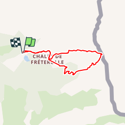
Trail Other activity of 6.1 km to be discovered at Auvergne-Rhône-Alpes, Upper Savoy, Morzine. This trail is proposed by olivieraron.
Positioning
Country:
France
Region :
Auvergne-Rhône-Alpes
Department/Province :
Upper Savoy
Municipality :
Morzine
Location:
Unknown
Start:(Dec)
Start:(UTM)
327435 ; 5113191 (32T) N.
Comments