


Saint Arnoult

lm178
User
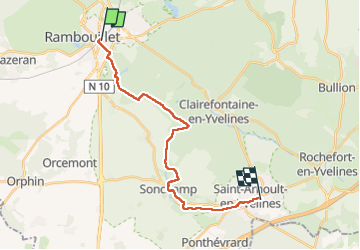

Length
19 km

Max alt
178 m

Uphill gradient
163 m
Km-Effort
21 km

Min alt
115 m

Downhill gradient
206 m
Boucle
No
Creation date :
2025-07-31 07:40:25.903
Updated on :
2025-07-31 14:45:26.445
5h08
Difficulty : Very easy

FREE GPS app for hiking
 SityTrail
IGN / Geographical institutes
SityTrail Plus
The world is yours!
About
Trail Walking of 19 km to be discovered at Ile-de-France, Yvelines, Rambouillet. This trail is proposed by lm178.
Positioning
Country:
France
Region :
Ile-de-France
Department/Province :
Yvelines
Municipality :
Rambouillet
Location:
Unknown
Start:(Dec)
Start:(UTM)
414006 ; 5388531 (31U) N.
Comments