


Refuge tré la tête descente par lac armancette

joelinou
User
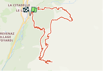

Length
14.8 km

Max alt
2070 m

Uphill gradient
1070 m
Km-Effort
29 km

Min alt
1170 m

Downhill gradient
1070 m
Boucle
Yes
Creation date :
2025-07-31 07:31:40.0
Updated on :
2025-07-31 15:29:26.658
7h56
Difficulty : Medium

FREE GPS app for hiking
 SityTrail
IGN / Geographical institutes
SityTrail Plus
The world is yours!
About
Trail Nordic walking of 14.8 km to be discovered at Auvergne-Rhône-Alpes, Upper Savoy, Les Contamines-Montjoie. This trail is proposed by joelinou.
Description
Très très belle course
Positioning
Country:
France
Region :
Auvergne-Rhône-Alpes
Department/Province :
Upper Savoy
Municipality :
Les Contamines-Montjoie
Location:
Unknown
Start:(Dec)
Start:(UTM)
323553 ; 5075453 (32T) N.
Comments