


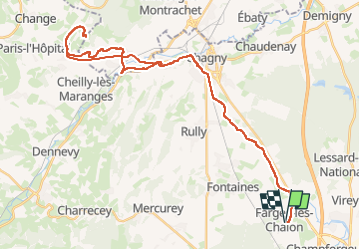
farges les chalon - mont des 3 croix

XavierFaidix
User

Length
45 km

Max alt
514 m

Uphill gradient
539 m
Km-Effort
53 km

Min alt
185 m

Downhill gradient
539 m
Boucle
Yes
Creation date :
2025-07-31 11:40:49.465
Updated on :
2025-07-31 15:43:22.754
3h00
Difficulty : Medium

FREE GPS app for hiking
 SityTrail
IGN / Geographical institutes
SityTrail Plus
The world is yours!
About
Trail Road bike of 45 km to be discovered at Bourgogne-Franche-Comté, Saône-et-Loire, Farges-lès-Chalon. This trail is proposed by XavierFaidix.
Positioning
Country:
France
Region :
Bourgogne-Franche-Comté
Department/Province :
Saône-et-Loire
Municipality :
Farges-lès-Chalon
Location:
Unknown
Start:(Dec)
Start:(UTM)
637746 ; 5188167 (31T) N.
Comments