


P col de Pré Long, col de Pré Molard, refuge de Pré Molard (Sav..) circuit 1er/8/2025

mapetite
User
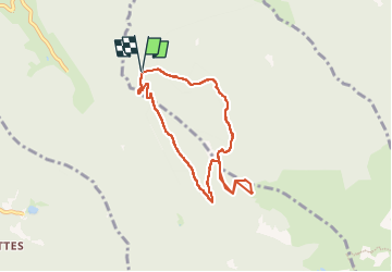

Length
7.4 km

Max alt
1737 m

Uphill gradient
536 m
Km-Effort
14.6 km

Min alt
1192 m

Downhill gradient
537 m
Boucle
Yes
Creation date :
2025-08-01 05:53:44.565
Updated on :
2025-08-01 13:30:18.144
2h58
Difficulty : Medium

FREE GPS app for hiking
 SityTrail
IGN / Geographical institutes
SityTrail Plus
The world is yours!
About
Trail Walking of 7.4 km to be discovered at Auvergne-Rhône-Alpes, Isère, Saint-Mury-Monteymond. This trail is proposed by mapetite.
Positioning
Country:
France
Region :
Auvergne-Rhône-Alpes
Department/Province :
Isère
Municipality :
Saint-Mury-Monteymond
Location:
Unknown
Start:(Dec)
Start:(UTM)
729182 ; 5009609 (31T) N.
Comments