


bessey

maclobar
User
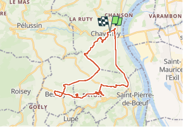

Length
17.9 km

Max alt
388 m

Uphill gradient
416 m
Km-Effort
23 km

Min alt
142 m

Downhill gradient
419 m
Boucle
Yes
Creation date :
2025-08-01 11:00:21.448
Updated on :
2025-08-01 15:44:18.156
4h42
Difficulty : Very difficult

FREE GPS app for hiking
 SityTrail
IGN / Geographical institutes
SityTrail Plus
The world is yours!
About
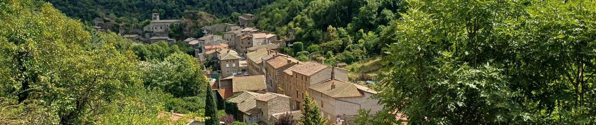
Trail Walking of 17.9 km to be discovered at Auvergne-Rhône-Alpes, Loire, Chavanay. This trail is proposed by maclobar.
Photos


Positioning
Country:
France
Region :
Auvergne-Rhône-Alpes
Department/Province :
Loire
Municipality :
Chavanay
Location:
Unknown
Start:(Dec)
Start:(UTM)
635579 ; 5030484 (31T) N.
Comments