


Segla (Ãle de Senja Norvège)

GOHIER
User
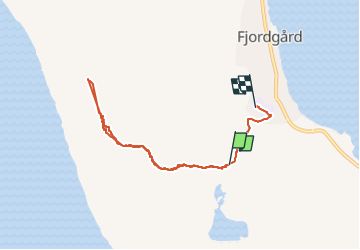

Length
3.6 km

Max alt
565 m

Uphill gradient
437 m
Km-Effort
9.7 km

Min alt
33 m

Downhill gradient
512 m
Boucle
No
Creation date :
2025-08-01 11:34:32.0
Updated on :
2025-08-01 15:48:48.185
3h06
Difficulty : Difficult

FREE GPS app for hiking
 SityTrail
IGN / Geographical institutes
SityTrail Plus
The world is yours!
About
Trail Walking of 3.6 km to be discovered at Troms og Finnmark. This trail is proposed by GOHIER.
Description
Chaleur et sentier pénible. Vue très belle en haut.
Positioning
Country:
Norway
Region :
Troms og Finnmark
Department/Province :
Unknown
Municipality :
Unknown
Location:
Unknown
Start:(Dec)
Start:(UTM)
602419 ; 7712471 (33W) N.
Comments