


Saint romain

lablaquiere
User
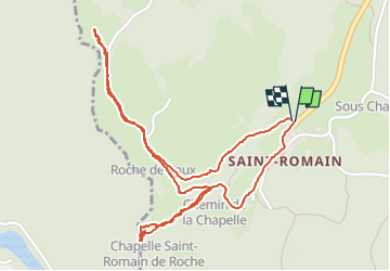

Length
2.9 km

Max alt
656 m

Uphill gradient
108 m
Km-Effort
4.3 km

Min alt
534 m

Downhill gradient
105 m
Boucle
Yes
Creation date :
2025-08-01 17:53:17.615
Updated on :
2025-08-01 19:15:50.17
54m
Difficulty : Easy

FREE GPS app for hiking
 SityTrail
IGN / Geographical institutes
SityTrail Plus
The world is yours!
About
Trail Walking of 2.9 km to be discovered at Bourgogne-Franche-Comté, Jura, Lavans-lès-Saint-Claude. This trail is proposed by lablaquiere.
Positioning
Country:
France
Region :
Bourgogne-Franche-Comté
Department/Province :
Jura
Municipality :
Lavans-lès-Saint-Claude
Location:
Pratz
Start:(Dec)
Start:(UTM)
711707 ; 5138372 (31T) N.
Comments