


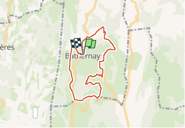
Bathernay parcours bleu

Vedett26
User

Length
7.6 km

Max alt
440 m

Uphill gradient
231 m
Km-Effort
10.7 km

Min alt
290 m

Downhill gradient
228 m
Boucle
Yes
Creation date :
2025-08-02 07:34:43.133
Updated on :
2025-08-02 10:17:33.784
2h31
Difficulty : Medium

FREE GPS app for hiking
 SityTrail
IGN / Geographical institutes
SityTrail Plus
The world is yours!
About
Trail Walking of 7.6 km to be discovered at Auvergne-Rhône-Alpes, Drôme, Bathernay. This trail is proposed by Vedett26.
Positioning
Country:
France
Region :
Auvergne-Rhône-Alpes
Department/Province :
Drôme
Municipality :
Bathernay
Location:
Unknown
Start:(Dec)
Start:(UTM)
656773 ; 5004867 (31T) N.
Comments