


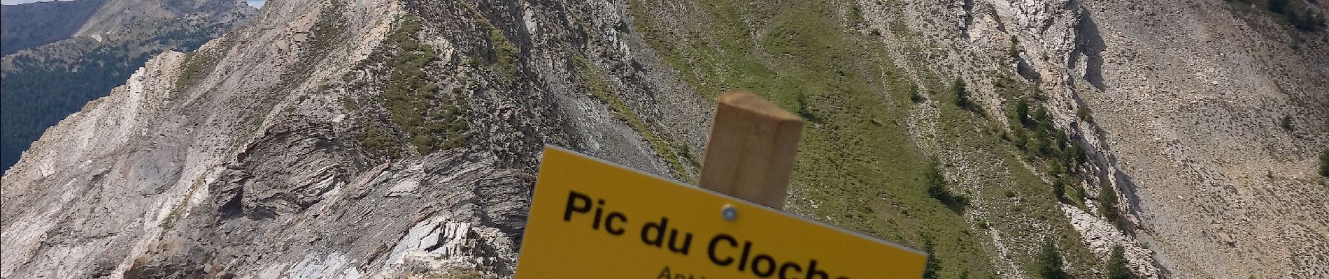
Antécime du Pic du Clocher 2367m

fredetpascale
User GUIDE
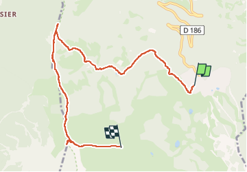

Length
8.6 km

Max alt
2392 m

Uphill gradient
633 m
Km-Effort
15.5 km

Min alt
1898 m

Downhill gradient
162 m
Boucle
No
Creation date :
2025-08-02 07:20:27.789
Updated on :
2025-08-02 12:56:19.954
3h10
Difficulty : Easy

FREE GPS app for hiking
 SityTrail
IGN / Geographical institutes
SityTrail Plus
The world is yours!
About
Trail Walking of 8.6 km to be discovered at Provence-Alpes-Côte d'Azur, Hautes-Alpes, Risoul. This trail is proposed by fredetpascale.
Description
Descente avec le télésiège du Belvédère de l'homme de Pierre 5â¬
Photos


Positioning
Country:
France
Region :
Provence-Alpes-Côte d'Azur
Department/Province :
Hautes-Alpes
Municipality :
Risoul
Location:
Unknown
Start:(Dec)
Start:(UTM)
312011 ; 4943686 (32T) N.
Comments