


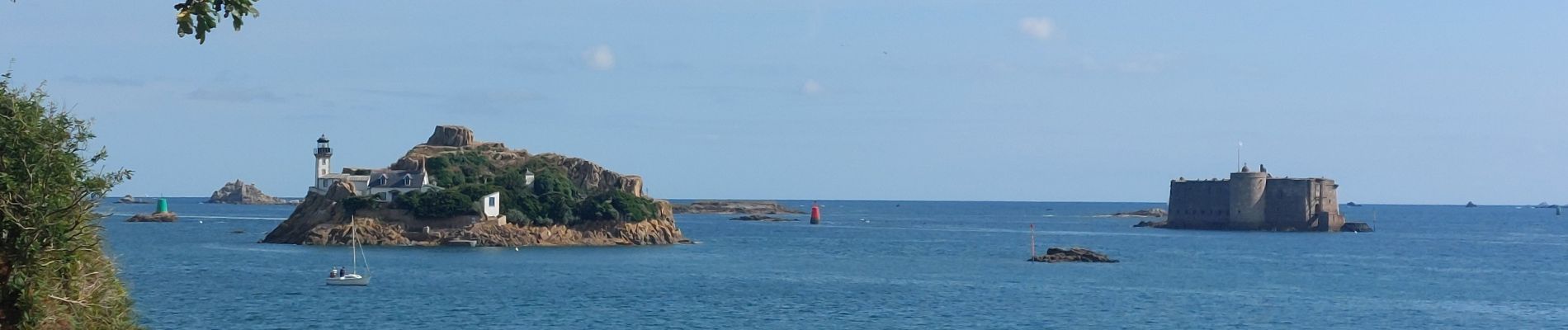
GR_34_FF_44_Carantec_St-Pol-De-Leon_20250802

patrickdanilo
User
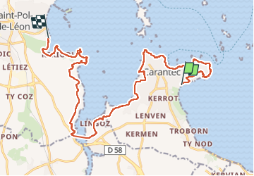

Length
19.2 km

Max alt
47 m

Uphill gradient
273 m
Km-Effort
23 km

Min alt
0 m

Downhill gradient
275 m
Boucle
No
Creation date :
2025-08-02 08:06:49.773
Updated on :
2025-08-06 17:07:28.019
4h50
Difficulty : Easy

FREE GPS app for hiking
 SityTrail
IGN / Geographical institutes
SityTrail Plus
The world is yours!
About
Trail Walking of 19.2 km to be discovered at Brittany, Finistère, Carantec. This trail is proposed by patrickdanilo.
Description
Randonnée Marche de 19,2 km à découvrir à Bretagne, Finistère, Carantec. Cette randonnée est proposée par patrickdanilo.
Photos


Positioning
Country:
France
Region :
Brittany
Department/Province :
Finistère
Municipality :
Carantec
Location:
Unknown
Start:(Dec)
Start:(UTM)
433393 ; 5390520 (30U) N.
Comments