


Cedron

jpblimond
User
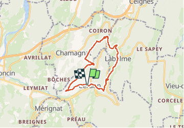

Length
12.8 km

Max alt
609 m

Uphill gradient
413 m
Km-Effort
18.3 km

Min alt
311 m

Downhill gradient
412 m
Boucle
Yes
Creation date :
2025-08-02 10:42:27.0
Updated on :
2025-08-02 14:38:17.506
3h54
Difficulty : Medium

FREE GPS app for hiking
 SityTrail
IGN / Geographical institutes
SityTrail Plus
The world is yours!
About
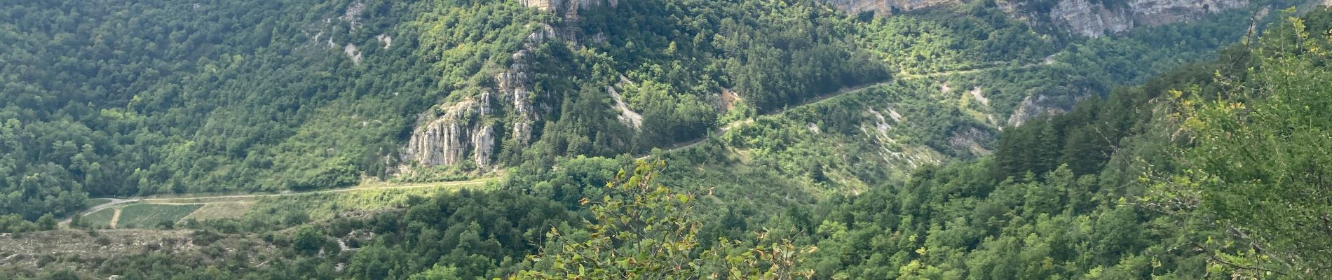
Trail Walking of 12.8 km to be discovered at Auvergne-Rhône-Alpes, Ain, Cerdon. This trail is proposed by jpblimond.
Photos


Positioning
Country:
France
Region :
Auvergne-Rhône-Alpes
Department/Province :
Ain
Municipality :
Cerdon
Location:
Unknown
Start:(Dec)
Start:(UTM)
690447 ; 5105946 (31T) N.
Comments