


R2 a Roche Turpin

CSR-94
User
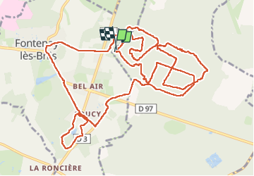

Length
17.4 km

Max alt
168 m

Uphill gradient
248 m
Km-Effort
21 km

Min alt
88 m

Downhill gradient
247 m
Boucle
Yes
Creation date :
2025-08-02 10:12:46.0
Updated on :
2025-08-02 15:00:57.174
4h47
Difficulty : Unknown

FREE GPS app for hiking
 SityTrail
IGN / Geographical institutes
SityTrail Plus
The world is yours!
About
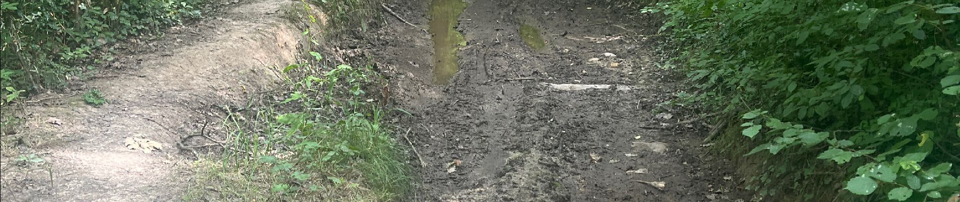
Trail Walking of 17.4 km to be discovered at Ile-de-France, Essonne, Bruyères-le-Châtel. This trail is proposed by CSR-94.
Photos


Positioning
Country:
France
Region :
Ile-de-France
Department/Province :
Essonne
Municipality :
Bruyères-le-Châtel
Location:
Unknown
Start:(Dec)
Start:(UTM)
439086 ; 5385434 (31U) N.
Comments