


soum de ouillère depuis cabanes de camoudiet

darancette
User
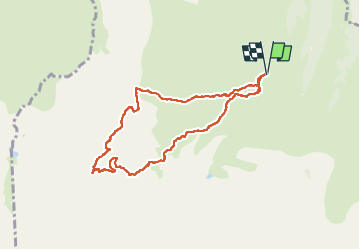

Length
8.7 km

Max alt
2443 m

Uphill gradient
1005 m
Km-Effort
22 km

Min alt
1433 m

Downhill gradient
1005 m
Boucle
Yes
Creation date :
2025-08-02 08:19:51.62
Updated on :
2025-08-02 15:18:45.752
3h30
Difficulty : Medium

FREE GPS app for hiking
 SityTrail
IGN / Geographical institutes
SityTrail Plus
The world is yours!
About
Trail Walking of 8.7 km to be discovered at Occitania, Hautespyrenees, Ancizan. This trail is proposed by darancette.
Positioning
Country:
France
Region :
Occitania
Department/Province :
Hautespyrenees
Municipality :
Ancizan
Location:
Unknown
Start:(Dec)
Start:(UTM)
277895 ; 4754188 (31T) N.
Comments