


Francorchamps

citytrailzwerts
User

Length
46 km

Max alt
622 m

Uphill gradient
1032 m
Km-Effort
60 km

Min alt
280 m

Downhill gradient
1033 m
Boucle
Yes
Creation date :
2025-08-03 07:44:01.0
Updated on :
2025-08-03 11:30:22.726
3h45
Difficulty : Very difficult

FREE GPS app for hiking
 SityTrail
IGN / Geographical institutes
SityTrail Plus
The world is yours!
About
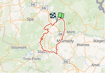
Trail Mountain bike of 46 km to be discovered at Wallonia, Liège, Stavelot. This trail is proposed by citytrailzwerts.
Description
Francorchamps
Positioning
Country:
Belgium
Region :
Wallonia
Department/Province :
Liège
Municipality :
Stavelot
Location:
Unknown
Start:(Dec)
Start:(UTM)
712058 ; 5596579 (31U) N.
Comments