


Balade Le Roux

edevuyst
User
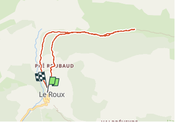

Length
8.5 km

Max alt
2141 m

Uphill gradient
404 m
Km-Effort
13.8 km

Min alt
1753 m

Downhill gradient
393 m
Boucle
Yes
Creation date :
2025-08-03 10:00:46.0
Updated on :
2025-08-03 15:27:28.116
2h10
Difficulty : Difficult

FREE GPS app for hiking
 SityTrail
IGN / Geographical institutes
SityTrail Plus
The world is yours!
About
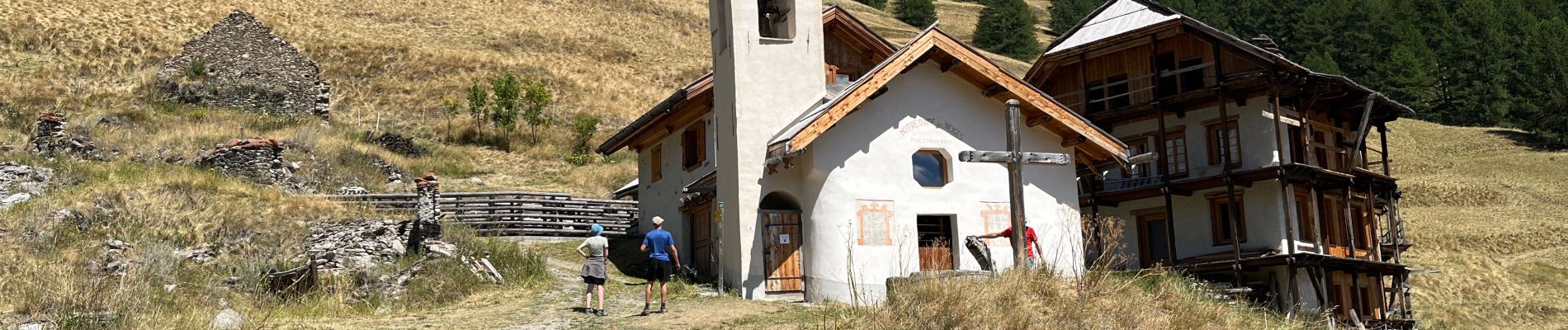
Trail Walking of 8.5 km to be discovered at Provence-Alpes-Côte d'Azur, Hautes-Alpes, Abriès-Ristolas. This trail is proposed by edevuyst.
Photos


Positioning
Country:
France
Region :
Provence-Alpes-Côte d'Azur
Department/Province :
Hautes-Alpes
Municipality :
Abriès-Ristolas
Location:
Unknown
Start:(Dec)
Start:(UTM)
337426 ; 4965013 (32T) N.
Comments