


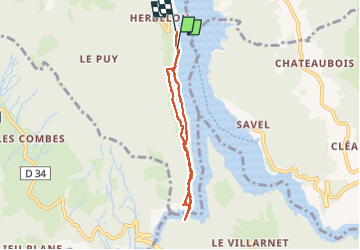
lac

Vero7684
User

Length
5.8 km

Max alt
573 m

Uphill gradient
201 m
Km-Effort
8.5 km

Min alt
487 m

Downhill gradient
204 m
Boucle
No
Creation date :
2025-08-03 13:39:30.786
Updated on :
2025-08-03 15:48:58.677
2h02
Difficulty : Medium

FREE GPS app for hiking
 SityTrail
IGN / Geographical institutes
SityTrail Plus
The world is yours!
About
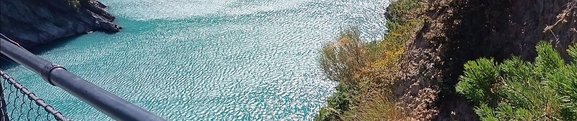
Trail Walking of 5.8 km to be discovered at Auvergne-Rhône-Alpes, Isère, Treffort. This trail is proposed by Vero7684.
Photos


Positioning
Country:
France
Region :
Auvergne-Rhône-Alpes
Department/Province :
Isère
Municipality :
Treffort
Location:
Unknown
Start:(Dec)
Start:(UTM)
711231 ; 4974434 (31T) N.
Comments