


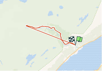
Glacier Steindalsbreen

GOHIER
User

Length
11.5 km

Max alt
549 m

Uphill gradient
729 m
Km-Effort
21 km

Min alt
51 m

Downhill gradient
729 m
Boucle
Yes
Creation date :
2025-08-03 12:01:06.0
Updated on :
2025-08-03 18:11:17.489
2h33
Difficulty : Easy

FREE GPS app for hiking
 SityTrail
IGN / Geographical institutes
SityTrail Plus
The world is yours!
About
Trail Walking of 11.5 km to be discovered at Troms og Finnmark. This trail is proposed by GOHIER.
Description
Un glacier à 450 m dâaltitude ! Très beau lac de moraine
Positioning
Country:
Norway
Region :
Troms og Finnmark
Department/Province :
Unknown
Municipality :
Unknown
Location:
Unknown
Start:(Dec)
Start:(UTM)
462141 ; 7696561 (34W) N.
Comments