


Fermanville Anse du brick

j.burnel
User

Length
16.9 km

Max alt
135 m

Uphill gradient
281 m
Km-Effort
21 km

Min alt
-1 m

Downhill gradient
279 m
Boucle
Yes
Creation date :
2015-08-05 00:00:00.0
Updated on :
2015-08-05 00:00:00.0
5h56
Difficulty : Easy

FREE GPS app for hiking
 SityTrail
IGN / Geographical institutes
SityTrail Plus
The world is yours!
About
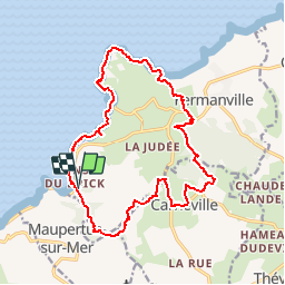
Trail Walking of 16.9 km to be discovered at Normandy, Manche, Fermanville. This trail is proposed by j.burnel.
Positioning
Country:
France
Region :
Normandy
Department/Province :
Manche
Municipality :
Fermanville
Location:
Unknown
Start:(Dec)
Start:(UTM)
609412 ; 5502923 (30U) N.
Comments