


Le long de la voie TGV

didierc13
User

Length
11.2 km

Max alt
248 m

Uphill gradient
159 m
Km-Effort
13.3 km

Min alt
148 m

Downhill gradient
162 m
Boucle
Yes
Creation date :
2025-08-04 05:36:43.0
Updated on :
2025-08-04 07:46:50.522
2h09
Difficulty : Easy

FREE GPS app for hiking
 SityTrail
IGN / Geographical institutes
SityTrail Plus
The world is yours!
About
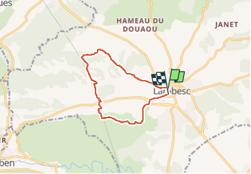
Trail Walking of 11.2 km to be discovered at Provence-Alpes-Côte d'Azur, Bouches-du-Rhône, Lambesc. This trail is proposed by didierc13.
Description
Belle promenade au milieu des vignes et dans les bois
Positioning
Country:
France
Region :
Provence-Alpes-Côte d'Azur
Department/Province :
Bouches-du-Rhône
Municipality :
Lambesc
Location:
Unknown
Start:(Dec)
Start:(UTM)
682255 ; 4835929 (31T) N.
Comments